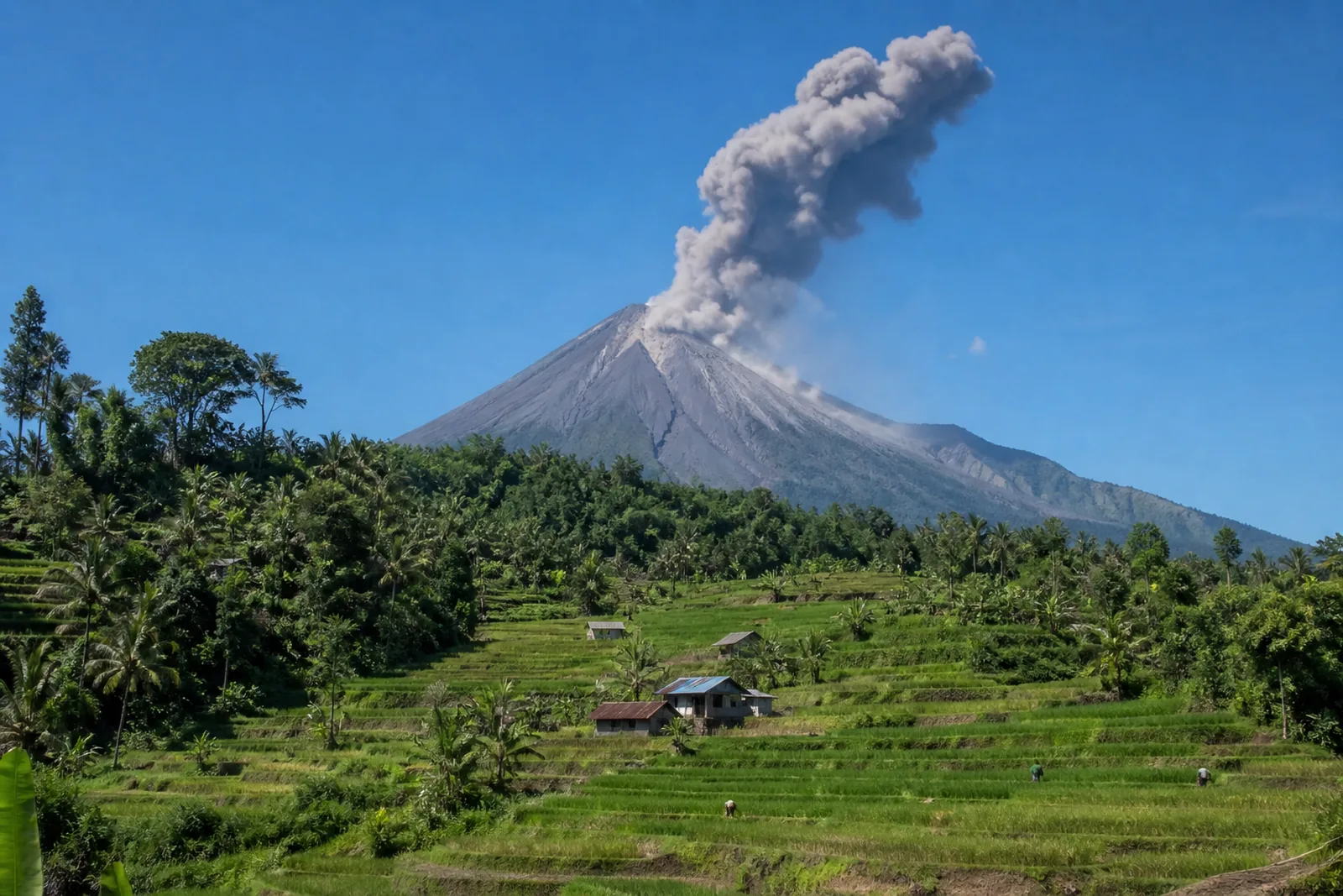
Mount Lewotobi Laki-laki erupts as authorities maintain alert status
Mount Lewotobi Laki-laki erupted on Friday morning, sending ash about one kilometre above its peak as authorities maintained a five-kilometre exclusion zone.
Mount Lewotobi Laki-laki in East Flores, East Nusa Tenggara, erupted on Friday morning, producing an ash column about one kilometre above its peak. Indonesia’s Geological Agency said the volcano remains at Level III, or Alert, with residents and tourists barred from activity within five kilometres of the eruption centre.
For travellers, businesses and investors following Indonesia’s operating environment, the immediate message is straightforward: rely on official monitoring and local-authority guidance, rather than speculation around an active geological event.
A short eruption, with a visible ash column
The eruption occurred at 7:35 a.m. local time and lasted about six minutes and four seconds, according to Lana Saria, head of the Geological Agency at the Energy and Mineral Resources Ministry.
The agency recorded the event on a seismogram with a maximum amplitude of 14.8 mm. It reported that thick ash was moving towards the southwest and west.
The ash column rose about one kilometre above the peak, according to the Geological Agency.
Such official details matter because they distinguish a reported event from the broader, often less reliable commentary that can follow volcanic activity. The agency’s guidance is based on observation and is the relevant reference point for people in the affected area.
Alert status and the exclusion zone
Lewotobi Laki-laki is currently classified at Level III, or Alert. Under the instructions cited by Antara, residents and tourists are prohibited from conducting activities within five kilometres of the eruption centre.
This is a practical restriction, not merely a technical designation. Visitors and operators in or near the affected area should treat the exclusion zone as an active safety requirement and follow directions issued locally.
The Geological Agency also asked nearby residents to remain calm, avoid unverified information and follow instructions from local authorities and the Lewotobi Laki-laki monitoring post in East Flores. Its emphasis on verified information is especially relevant where fast-moving updates can be amplified without context.
Ash protection and lahar vigilance
The agency urged people near the volcano to wear masks or cover their noses and mouths, citing the respiratory hazards posed by volcanic ash. This is a direct public-health precaution for those exposed to ashfall.
Authorities also warned residents to watch for rain-triggered lahars along rivers originating from the summit during heavy rain. The locations specifically identified were:
- Dulipali
- Padang Pasir
- Nobo
- Nurabelen
- Klatanlo
- Hokeng Jaya
- Boru
- Nawakote
The warning underlines that volcanic risk management does not end when an eruption is recorded. Conditions around waterways and rainfall may require separate attention, which is why the agency has linked its advice to heavy-rain periods and rivers flowing from the summit.
Official coordination remains central
Lana Saria said the Center for Volcanology and Geological Hazard Mitigation would coordinate with the East Nusa Tenggara disaster agency and local authorities to provide information on the volcano’s activity.
That coordination is important for anyone making near-term decisions connected with the affected area. A single report can establish what occurred, but operational choices should remain tied to the agencies responsible for monitoring, local safety instructions and disaster response.
Antara also reported related volcanic activity in eastern Indonesia on Friday morning. The present report, however, concerns the Lewotobi Laki-laki eruption in East Flores and the restrictions and precautions announced by the Geological Agency.
What this means for investors
Investors with exposure to Indonesian travel, hospitality or property should separate immediate safety guidance from broader assumptions. The confirmed facts are that Lewotobi Laki-laki erupted on Friday morning, remains at Alert status, and is subject to a five-kilometre activity restriction around the eruption centre.
A disciplined response is to monitor official notices, confirm conditions with local operators where relevant, and avoid treating unverified reports as decision-grade information. The agency has explicitly called on residents to follow local authorities and the Lewotobi Laki-laki monitoring post.
For those assessing Indonesia from abroad, this episode is also a reminder that local operational diligence matters. Safety restrictions, ash precautions and rainfall-related lahar warnings are specific to the conditions described by authorities; they should be understood on those terms rather than extrapolated beyond the available information.
The next meaningful updates will come from the monitoring and disaster-management authorities coordinating in East Nusa Tenggara.
Stay informed, subscribe to the free Lombok Briefing for analysis like this, published twice a month.
What happened at Mount Lewotobi Laki-laki?
Mount Lewotobi Laki-laki in East Flores erupted on Friday morning at 7:35 a.m. local time. The Geological Agency said the event lasted about six minutes and four seconds and sent an ash column about one kilometre above the peak.
What restrictions are in place around Lewotobi Laki-laki?
Lewotobi Laki-laki is at Level III, or Alert. Indonesia’s Geological Agency said residents and tourists are prohibited from conducting activities within five kilometres of the eruption centre and should follow instructions from local authorities and the monitoring post.
What precautions did authorities advise for nearby residents?
The Geological Agency advised residents near Mount Lewotobi Laki-laki to wear masks or cover their noses and mouths because volcanic ash can pose respiratory hazards. It also urged vigilance for rain-triggered lahars along rivers originating from the summit during heavy rain.

The Lombok Buyer's Field Guide
Legal structures ranked by risk, the honest ROI math line by line, all six zones ranked, and the 24-point due-diligence checklist. The whole book, free in your inbox.
See what's inside